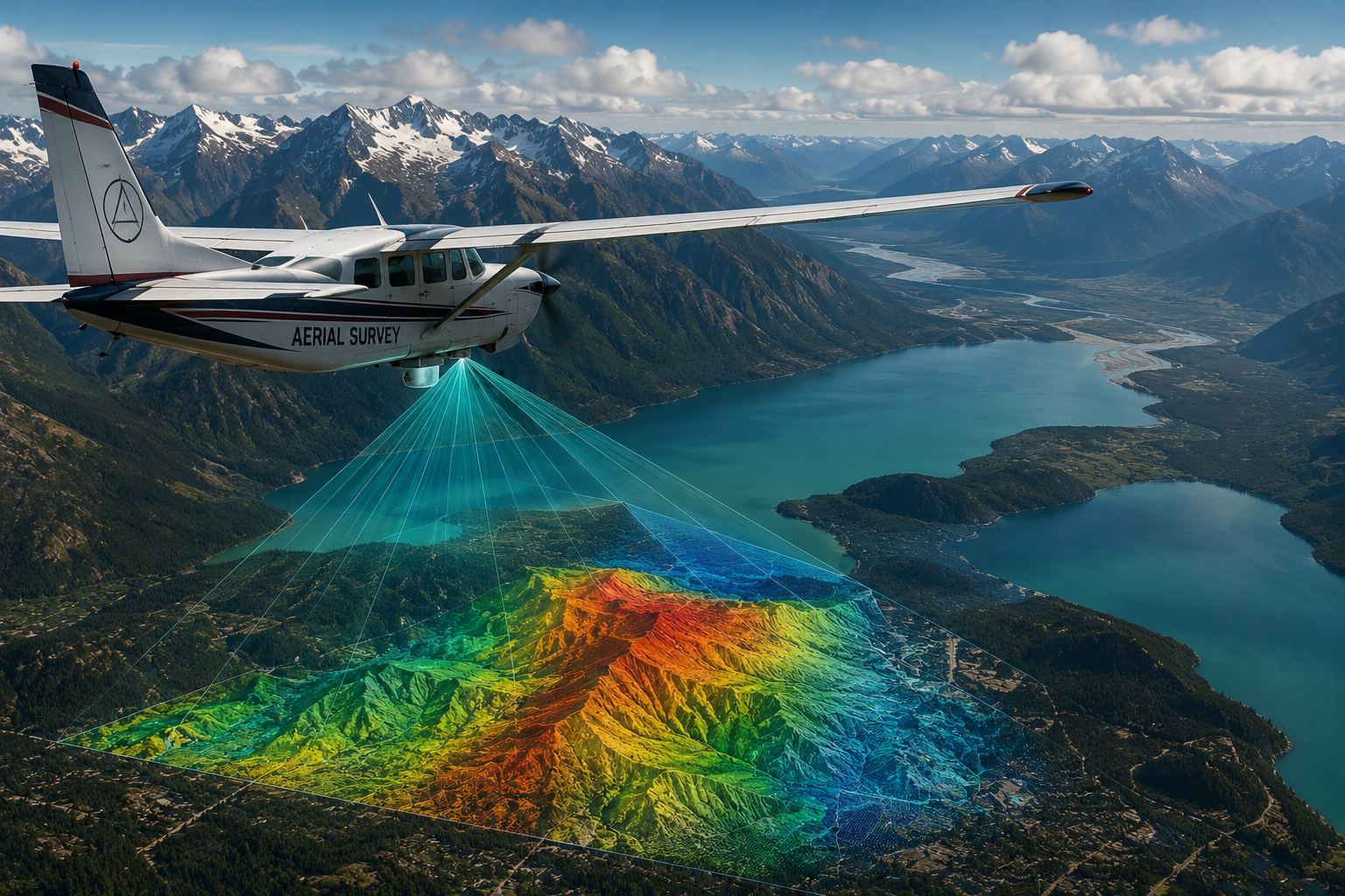
What Is an Aerial Survey Pilot?
Aerial survey pilots fly aircraft equipped with cameras, sensors, and mapping technology to collect geographic and environmental data.
Their work supports:
- Infrastructure planning
- Environmental studies
- Mapping
- Urban development
- Agriculture
- Government research
Roles and Responsibilities
Survey pilots:
- Fly precise flight patterns
- Operate aircraft at specific altitudes and speeds
- Support mapping and imaging systems
- Coordinate with survey technicians
- Maintain stable aircraft positioning
Work Environment
Aerial survey pilots often fly:
- Small aircraft
- Twin-engine aircraft
- Specialized sensor-equipped aircraft
Flights may occur over:
- Cities
- Forests
- Coastlines
- Construction projects
- Agricultural areas
Expected Salary
Estimated salary ranges:
- Entry-level survey pilot: $50,000–$80,000
- Experienced survey pilot: $90,000–$140,000+
Salary Sources:
- U.S. Bureau of Labor Statistics
- Industry aviation recruitment sources
Education and Training
Requirements typically include:
- Commercial Pilot License
- Instrument Rating
- Strong navigation skills
- Low-altitude flying experience
Knowledge of mapping technology and GIS systems can be helpful.
Notable Employers
- Government mapping agencies
- Environmental consulting firms
- Survey aviation companies
- Infrastructure engineering firms
Why Students Choose This Career
Students interested in technology and aviation often enjoy:
- Precision flying
- Geographic technology
- Scientific missions
- Unique flight operations
FAQs
What does aerial survey aviation support?
It supports mapping, engineering, agriculture, and environmental analysis.
Do survey pilots take photographs?
Yes. Aircraft may carry advanced imaging systems and sensors.
Is aerial survey flying seasonal?
Some projects are seasonal depending on weather and mapping conditions.
Ready to soar in your aviation career?