
On the ground, we are able to make our way from Point A to Point B by knowing where to turn on roads, guided by maps, GPS, or memory. Even while traversing areas in which roads aren’t available, backpackers find their way by using a compass to point them in the right direction. But how does this apply in the air for pilots? How do they know they haven’t overshot their targets, and how was this accomplished before air navigation charts (opens in a new window) and a cockpit GPS?
The answer to how pilots navigate the skies is tied into the history of aviation. It involves not only slowly developing technology but the very structure of the Earth. We also have innovative members of the aviation community to thank for making navigation the safe and effective system it is. The better you know and understand it, the better you are able to find your way in the air.
Pilot Navigation: Finding Our Way From Above
The most basic form of navigating from the skies is flying under VFR or visual flight rules. Without GPS or even radio aids on the horizon, the first pilots found their way just as they did on the ground—by the compass and looking for natural landmarks such as towns, hills, lakes, or even church steeples.
This is called pilotage. However, pilotage forced the pilot to take his or her eyes off the horizon or the instruments in the cockpit. Using this as the sole source of navigation wasn’t safe, consistent, or trustworthy. It was easy for a pilot to drift away from the route. Flying longer distances in even slightly less than perfect weather meant that aviation experiences were limited. VFR also asks pilots to “see and avoid,” or refrain from flying through cloud formations. They are also responsible for maintaining a certain distance from other aircraft.
As aviation advanced and navigation aids were produced, pilots began to rely on dead reckoning (opens in a new window). This form of navigation, like pilotage, is still used, but demands preparation. For dead reckoning to work, pilots must not just become familiar with visual markers on the ground but also work out how much time is involved with flying from one point to another in order to match the landmark with a map.
Navigation by dead reckoning demands proper calculations involving windspeed, wind direction, airspeed, and other factors. Today, flight computer assist in this task, but originally, a manual flight planning log was necessary to juggle in the cockpit along with other basic aviation tasks.
IFR and Radio Navigation
The advent and deployment of radio navigation made it possible for pilots to fly not only more efficiently and safely in good weather, but in adverse weather conditions as well. Radio navigation enables navigation via IFR, or instrument flight rules. It was originally known as “blind flying”; in order to operate an aircraft under IFR, pilots must obtain an instrument rating from the FAA.
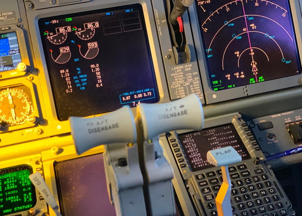
Radio navigation aids are known as NAVAIDS. They are always part of flying IFR and may be used as a reinforcement for VFR. Different elements of it are used for navigation: VOR, ADF/NDB, ILS, and DME.
VOR is an acronym for VHR Omnidirectional Radio Range. Pilots can find it in a frequency range which is very high, meaning that it is usually not detected by general consumer tuners such as transistor radios or car antennas. Two signals are involved with VOR. While both are located at ground level, one sweeps in a circle and the other located directionally. VOR is not as accurate or easy to use as GPS, as it does not involve satellite information, but it is trustworthy and used by many pilots as GPS backup.
Using ADF/NDB
ADF/NDB was one of the first navigation systems available to pilots which may still be relied upon. The NDB (non-directional beacon) sends a signal to an antenna located within the airplane. Within the aircraft’s cockpit is an instrument known as the ADF or the automatic direction finder. The ADF shows where the aircraft is located in relation to the beacon. Using this information, the pilot directs the airplane to the source of the signal. He or she then tunes in to the next beacon on the route and repeats the process until it is time to land.
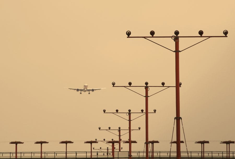
Landing is when the ILS, or the instrument landing system, comes into play. Radio signals are sent from within the runway. From this, the pilot is given a glideslope—or safe path of descent—to follow down to the runway.
While ADF/NDB was more reliable and efficient than visually attempting to navigate in the air, the signal was not always trustworthy. Flying at sunrise, sunset, or in thunderstorms sometimes meant interference. Terrain in mountainous areas also produced erroneous signals. Most worryingly, the airplane’s antenna might produce erroneous readings while in a bank turn. This is known as a “bank error.”
DME and GPS
DME is short for Distance Measuring Equipment. It relies on use of a transponder. Broadcast on a UHF (ultra high frequency) band, the signal is received by the aircraft’s equipment. The DME’s signal is used to determine distance. Pilots can then use this information, usually shown by the transponder in the form of tenths of a nautical mile, to plot the path of the airplane. Sometimes DME equipment is paired with VOR stations.
Most pilots are now familiar with GPS or a global positioning system. First available as an individual navigation aid, many aviators now expect a GPS as part of a basic glass cockpit design. Though not infallible, GPS is highly accurate and is not subject to atmospheric interference, antenna errors, or natural features which might block signals.
Three dimensional and operative in real time, GPS depends on 24 satellites to locate the airplane and guide it along its flight path. Sometimes, GPS provide 2D reckoning, which involves input from at least three satellites (3D information demands four operative satellites.) GPS is useful not only directionally, but in automatically calculating speed and precise position.
Ready to soar in your aviation career?
Mr. Matthew A. Johnston has over 23 years of experience serving various roles in education and is currently serving as the President of California Aeronautical University. He maintains memberships and is a supporting participant with several aviation promoting and advocacy associations including University Aviation Association (UAA), Regional Airline Association (RAA), AOPA, NBAA, and EAA with the Young Eagles program. He is proud of his collaboration with airlines, aviation businesses and individual aviation professionals who are working with him to develop California Aeronautical University as a leader in educating aviation professionals.
Good explanation to be understood by commonman even.